A look at the historyof Kleiner Grasbrook
The new Grasbrook neighborhood is being created on a site that has undergone great change over the centuries. Up until the Middle Ages Grasbrook (Brook = damp marshland) was grazing land outside the city walls. It was not until 1850 that Kleiner Grasbrook began to be developed as the first port area on the south bank of the Elbe’s northern arm. The Elbe bridges were built to connect Hamburg and Harburg.
From the 19th century onwards, the constant expansion of sea-going cargo handling shaped the area. In the 1960s, harbor basins were gradually filled in, initially parts of Moldauhafen for the construction of the Überseezentrum and, from the 1970s onwards, large areas of Segelschiffhafen to create further logistics and storage areas. In 2016, HHLA abandoned the Überseezentrum because it was insufficiently profitable. The idea of a new Grasbrook neighborhood was presented publicly for the first time in September 2017.

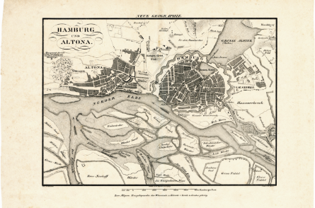
1833
An illustration of Hamburg and Altona in 1833. There are no detectable harbor activities on the southern banks of the Norderelbe.
Image: © Christian Terstegge
1899
The development of port and industry on Kleiner Grasbrook starts in 1850. Narrow quays and warehouses are built for the transshipment of general cargo. The first workers’ housing is built on Veddel.
Image © Hamburg Port Authority (HPA)

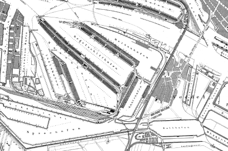
1932
The brick buildings on Veddel are constructed to the designs of Fritz Schumacher. Today’s Grasbrook area is characterized by Moldauhafen, Segelschiffhafen and Saalehafen.
Image © hhla.de / hamburgerfotoarchiv.de
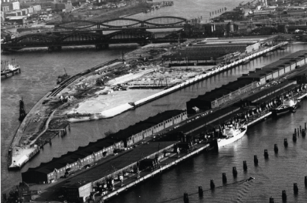
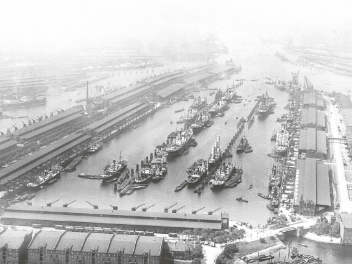
1964
Large areas of Moldauhafen are filled in from 1962 for the construction of the Überseezentrum. The Überseezentrum, the world’s largest consolidation and distribution warehouse, opens in 1967.
Image © O+P Geotechnik GmbH
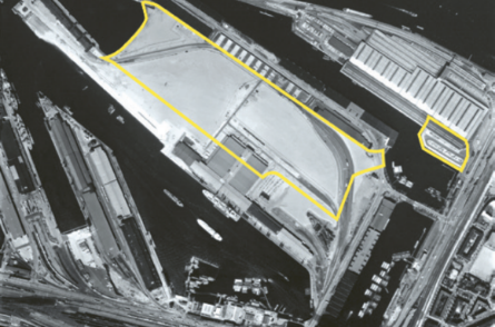
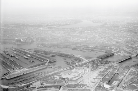
1975
1975 to 1978 large areas of Segelschiffhafen are filled in. The narrow quays for direct transshipment make room for extensive logistics areas and warehouses.
Image © Hamburg Port Authority (HPA)
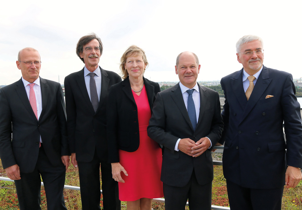
2017
The then First Mayor Olaf Scholz introduces the Grasbrook district at a regional press conference on 12 September 2017.